The Roman period is when we might expect more activity in around Green Hammerton. Why? It’s right next to the Roman road from York to Cramond.
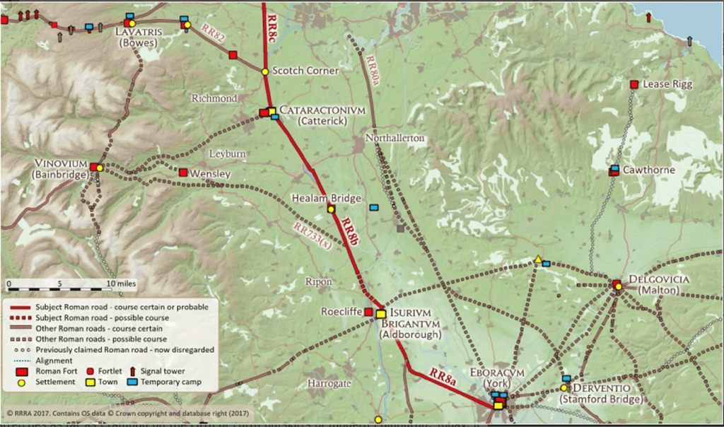
RR8 is our Margary number, and the section through Green Hammerton is RR8a. This is the section of road from York (Eboracum) to Aldborough (Isurium Brigantum). Often this road is referred to as Dere Street, but that is not a name the Romans would have used. Dere Street is likely of medieval origin, referring to the Kingdom of Deira. The route of the road from York broadly follows the modern A59.
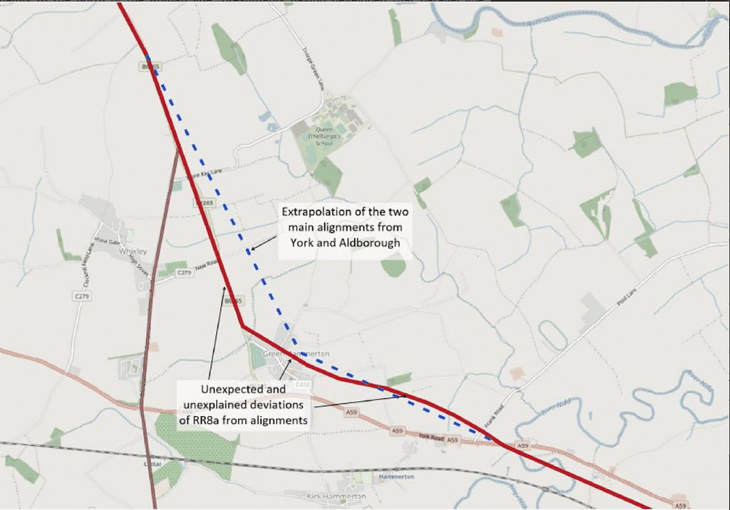
One thing that is not exactly clear is the exact path of the road through Green Hammerton, and why it seems to deviated from a more logical alignment.
One of the areas we are studying is the road location just to the west of the village where the road is clearly visible from aerial photography:
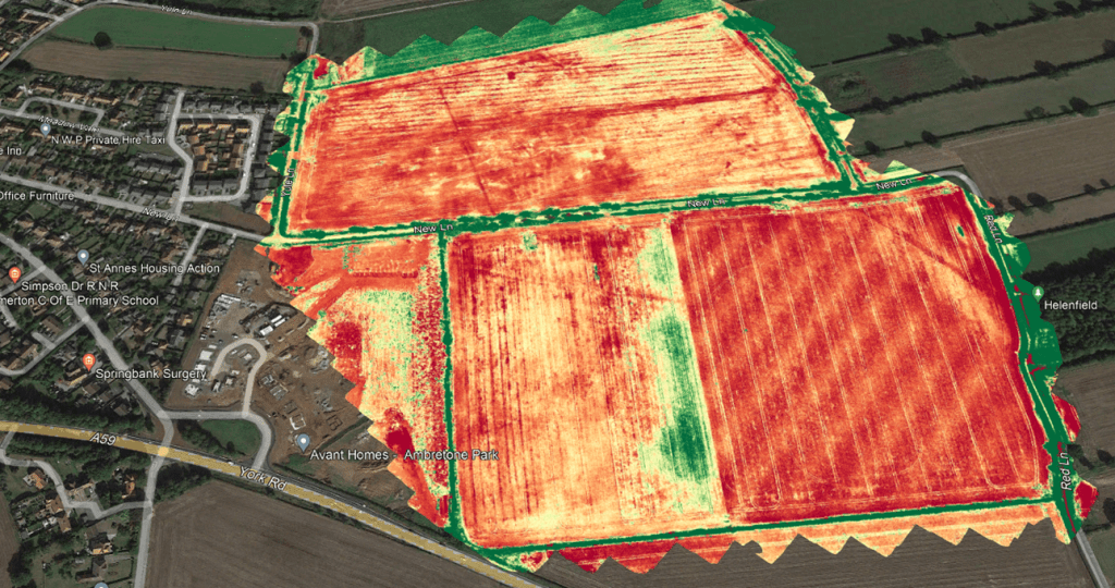
The road is visible from the air running across the field, it can also be seen on LIDAR also. We’d like to do further work on this, and excavations. Current research suggested the road ran north west through the housing development undertaken in the past couple of years by Strata homes. However given it is absent from geophysical surveys in that field it seems this may not be the case. This is an area we are focussing on, and our current thinking is that the modern road (New Lane) actually lies on top of the Roman road.
Further east, near Skipbridge, a possible Roman settlement was excavated which lay next to the path of the road. This was excavated in ~2008 as part of a pipeline laying project. Full details of the excavation are yet to be published.
The final exciting Roman find from Green Hammerton is the Roman burial which was found during drainage ditch digging in 1971.
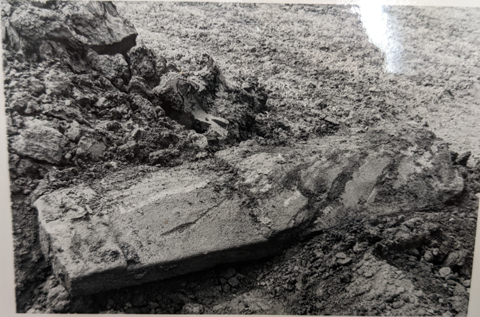
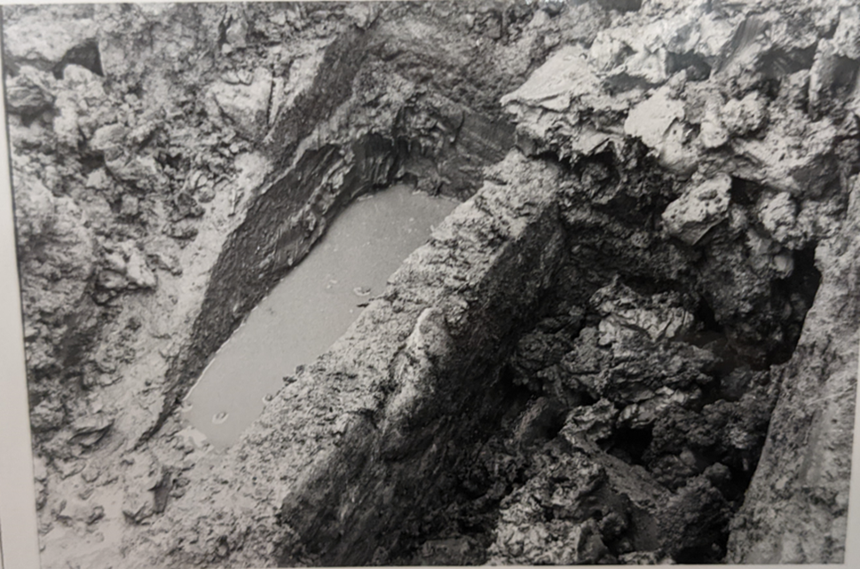
The photos above are taken from the archives of the Yorkshire Museum where the coffin and the associated finds are now held. The skeleton in the coffin final location is unknown. We know it was male, around 5’7″ tall, but that is all we now. Given the size of the coffin (2m of solid stone), we can guess he was likely of a higher status, but we know nothing more beyond that.
Along with the coffin, field walking produced Roman pottery in the same area as the coffin:
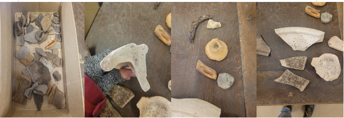
The pottery is later than Iron Age, probably from around 1st – 3rd Century AD. Some Samian ware pieces were found, which suggests a date from 2nd century as Samian ware production ceased in 230AD. Samian ware is usually a red-brown colour, often stamped with designs, and import from Gaul.
The large flat white pieces are from Roman mortaria. A mortarium was a large, flat dish, used in Roman cooking. The inside of the dish was coarse, and the mortarium was used for grinding, pounding and mixing foods. It’s where we get the word mortar from, as in mortar and pestle.
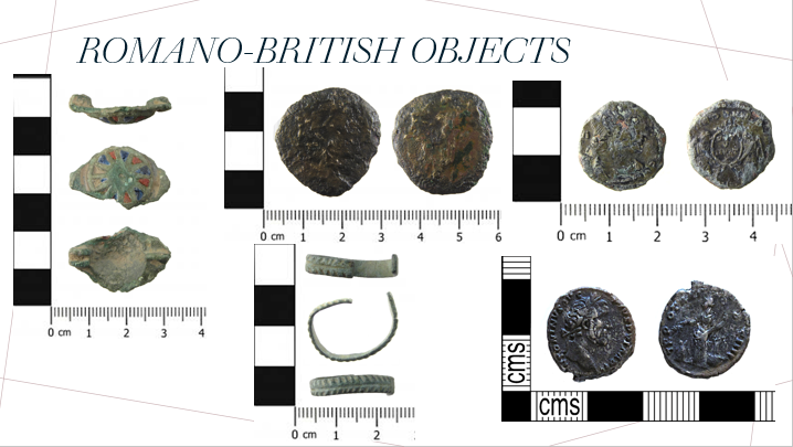
Finally, the PAS shows a number of Roman items. Coins of course are easily dateable.
The earliest here is in the bottom right, it’s a silver denarius showing the Emperor Antoninus Pious. This was struck in the mid 2nd century AD, and it relatively unworn suggesting it hadn’t been circulating for long when it was lost.
The latest coin is that in the top right, showing the Emperor Magnetius, struck in the 350s. You can see the coin has been trimmed in size (it has straight trimmed edges), as coin values were rapidly changed in the mid-4thC.
The brooch on the left is from the 1st or 2nd century AD. It’s a nice brooch, not hugely high status, but something a Roman would have worn as their “Sunday best”. Finally in the bottom middle we have a 3rd or 4th century finger ring.
So the Roman period has some interesting evidence from in and around Green Hammerton, and we have a number of future research areas to look into.