In this series of articles, we will summarize the talk that we recently gave at the Village Club covering “The Archaeology of Green Hammerton: What We Know So Far”.
In the first part, we will look at sources of information we can use to find out about the archaeology of our village.
Even without putting a shovel into the ground we can find out a great deal about our past using the many sources of information available to us already, from new research and techniques, through to existing digs.
Every archaeological investigation begins in this way, with a desk based assessment. We must understand as much as we can about the wider archaeological, landscape, historical and geological context of an archaeological site.
We have used seven sources of information to give us an idea of work that has already occurred in the parish.
Historic Environment Record
The HER is maintained by the local council or local authority, and lists all of the archaeological and historical information in a given area. You can find the HER online.
The HER originally started life as the Sites and Monuments Record to record archaeology only, but expanded over time to cover all historical information, so it includes things like listed buildings for example.
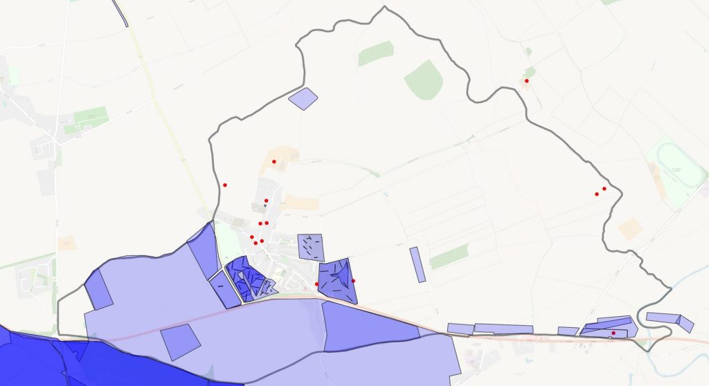
This maps shows the outline of GH parish. The dots and squares are heritage events – which could be a variety of different things. There’s more than 50 records for Green Hammerton, some of which we know a lot about, and some we don’t yet.
Planning Records
Before building and development can take place, archaeological surveying has to take place. In GH, we’ve had five of these surveys, along with accompanying excavations, in the past 5 or so years.
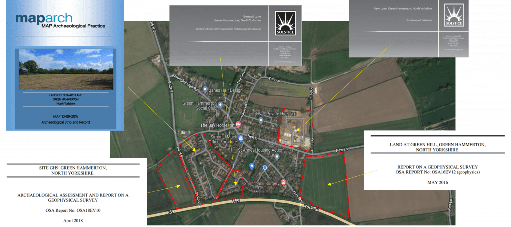
These are undertaken by commercial archaeological organizations, and consist of:
- A desk based survey
- A geophysics survey
- Trial excavation
A geophysics survey gives valuable information about any features which might be below the ground. These can be done quickly and easily over a large area (such as a field which is going to be developed). On the basis of the survey, excavations can be targeted as specific features buried under the soil.
We have five of these surveys and excavations done in Green Hammerton, we’re probably one of the best investigated and excavated parishes in North Yorkshire in recent years.
Aerial Surveys
Viewing a site from the air can reveal information that is simply not visible from the ground. In the 20th century, this was done using aircraft, but in recent years drones have taken their place. This can give us lots of information about ground formations (lumps and bumps) that might not be visible from the ground, but can also show information about how crops are growing. The growth of crops can be affected by buried features, and can give us information about what shapes might lie below the surface.
Aerial surveying in Green Hammerton has been done in conjunction with Yorkshire Archaeological Aerial Mapping.